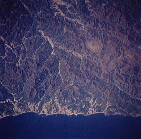
This image shows an oblique view of a section of the east-central coast
of Korea and the backbone of the Taebaek-San Maek Mountains. Amidst the rugged hills you
can see a shallow circular depression, nicknamed "The Punchbowl" during the
Korean War. Some of the bitterest battles of the war were fought in and around this
topographic feature. The Demilitarized Zone runs diagonally from the top-center of the
image to the right-center, tangent to the Punchbowl. North is to the right.
NASA Shuttle photograph #STS058-0089-0067 (EarthRISE Archive)
![]()
HTML code by Chris Kreger
Maintained by ETE Team
Last updated April 28, 2005
Some images © 2004 www.clipart.com
Privacy Statement and Copyright © 1997-2004 by Wheeling Jesuit University/NASA-supported Classroom of the Future. All rights reserved.
Center for Educational Technologies, Circuit Board/Apple graphic logo, and COTF Classroom of the Future logo are registered trademarks of Wheeling Jesuit University.