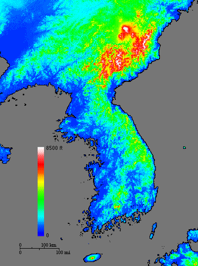
Topographic Map of Korea
Low elevations are in greens and yellow, high elevations in reds and white. The original topographic data, modified for use with this map, were obtained from the Global 30 Arc-Second Elevation Data Set, archived at the Distributed Active Archive Center (DAAC), located at The Earth Resources Observation Systems (EROS) Data Center.
![]()
HTML code by Chris Kreger
Maintained by ETE Team
Last updated April 28, 2005
Some images © 2004 www.clipart.com
Privacy Statement and Copyright © 1997-2004 by Wheeling Jesuit University/NASA-supported Classroom of the Future. All rights reserved.
Center for Educational Technologies, Circuit Board/Apple graphic logo, and COTF Classroom of the Future logo are registered trademarks of Wheeling Jesuit University.