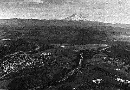
Image of an aerial photograph showing the town of Orting and Mt. Rainier in the distance.  This image links to an enlargement of area shown in Orting aerial photograph.
This oblique aerial photograph shows the town of Orting at left center and Mount Rainier in the distance. The Puyallup River runs down the center of the image; the Carbon River is visible along the left side. Forest can be seen on the hills at left center, upper center, and right center. All of them are regrowing forests. For a satellite view of this area, click on the image.

Photo: Courtesy of Pat Pringle

Button that takes you back to the Temperate Rainforest main page.


HTML code by Chris Kreger
Maintained by ETE Team
Last updated November 10, 2004

Some images © 2004 www.clipart.com

Privacy Statement and Copyright © 1997-2004 by Wheeling Jesuit University/NASA-supported Classroom of the Future. All rights reserved.

Center for Educational Technologies, Circuit Board/Apple graphic logo, and COTF Classroom of the Future logo are registered trademarks of Wheeling Jesuit University.