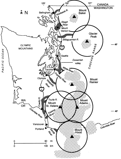
| Figure 1 Diagrammatic representation of volcanic hazard zones in the Cascade Range in Washington and northern Oregon, modified from Hobblitt and others (1987). Circles show proximal hazard zones with a radius of 50 km; stippled pattern shows hazards from eruptions of basaltic volcanoes and volcanic fields; crosshatched pattern shows distal lahar and laharic-flood hazard zones. Some valleys, such as the Skagit or Puyallup, face a higher hazard of lahars than other valleys, such as the Stillaguamish. |
|
HTML code by Chris
Kreger Some images © 2004 www.clipart.com Privacy Statement and Copyright © 1997-2004 by Wheeling Jesuit University/NASA-supported Classroom of the Future. All rights reserved. Center for Educational Technologies, Circuit Board/Apple graphic logo, and COTF Classroom of the Future logo are registered trademarks of Wheeling Jesuit University. |