Drought
Satellite Images
Below are a series of satellite images with questions that will help you develop a better understanding of drought.
Image 1: Drought in the Black Hills
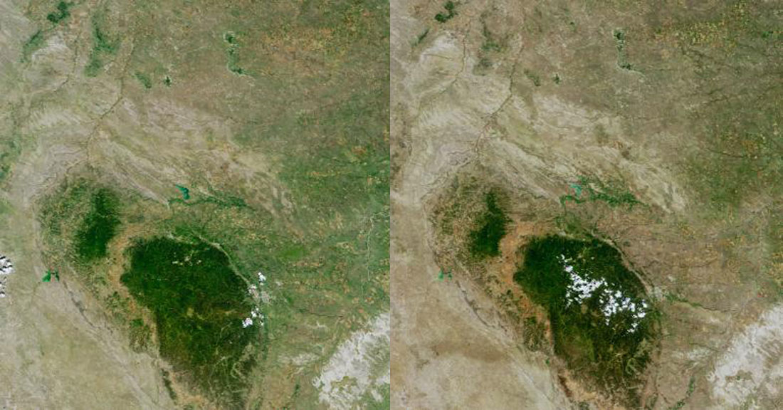
Left: July 12, 2000. Right: July 24, 2004.
Question
What changes do you see in the Black Hills from 2000 to 2004 that demonstrate the occurence of drought?
Discuss your thoughts and findings on NASATalk.
For more information on this image, go to Featured Data: Drought in the Black Hills.
Image 2: Growth of San Antonio
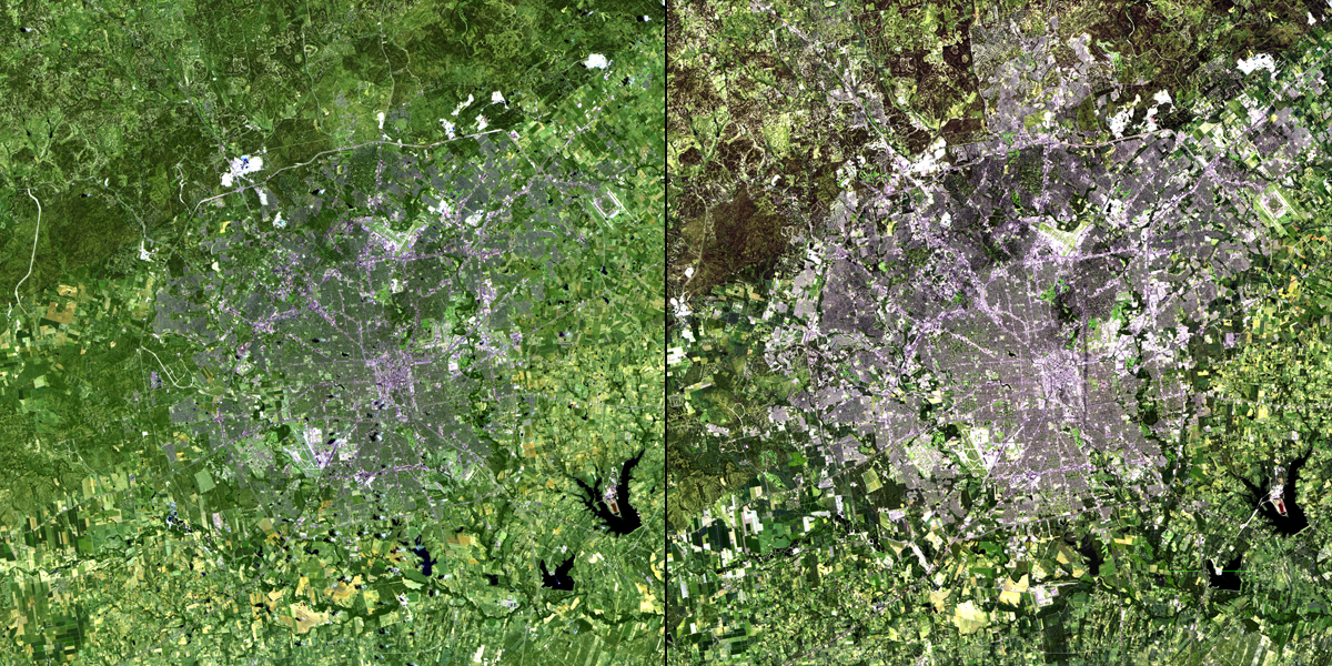
Left: June 16, 1991. Right: June 4, 2010.
Question
What can you determine about San Antonio from viewing these two images?
Discuss your thoughts and findings on NASATalk.
For more information about this image, go to Featured Data: Growth of San Antonio.
Image 3: Okey Dokey Okeechobee?
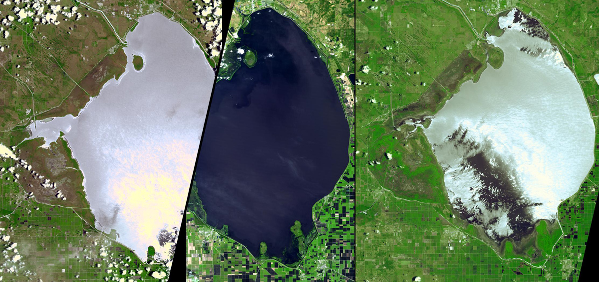
Left: June 19, 2000. Middle: January 19, 2003. Right: June 23, 2007.
Question
What changes can you identify from comparing these three photos of Lake Okeechobee?
Discuss your thoughts and findings on NASATalk.
For more information about this image, go to Featured Data: Okey Dokey Okeechobee.
Image 4: Shrinking Lake Chad
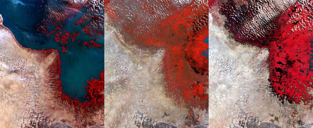
Left: December 8, 1972. Middle: December 14, 1987. Right: December 18, 2002.
Question
What do you think will happen to Lake Chad in the future?
Discuss your thoughts and findings on NASATalk.
For more information about this image, go to Featured Data: Shrinking Lake Chad.
Image 5: Drying Out
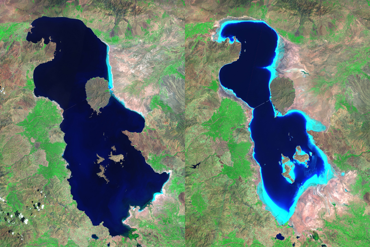
Left: August 1985. Right: August 2010.
Question
What do you think are some of the causes for Lake Oroumeih drying out?
Discuss your thoughts and findings on NASATalk.
For more information about this image, go to Featured Data: Drying Out.


