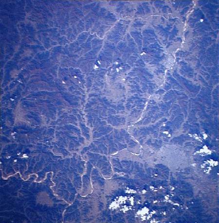
This image shows a section of the central highlands around the South
Korean city of Taegu (gray blotch at lower right). The Naktong River winds diagonally
across the image from the lower left to upper right. Note the rugged and hilly nature of
the countryside. The field of view is about 100 km across. North is to the upper right.
NASA Shuttle photograph #STS61A-0045-0068 (EarthRISE Archive)
![]()
HTML code by Chris Kreger
Maintained by ETE Team
Last updated April 28, 2005
Some images © 2004 www.clipart.com
Privacy Statement and Copyright © 1997-2004 by Wheeling Jesuit University/NASA-supported Classroom of the Future. All rights reserved.
Center for Educational Technologies, Circuit Board/Apple graphic logo, and COTF Classroom of the Future logo are registered trademarks of Wheeling Jesuit University.