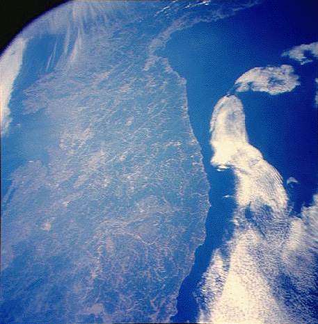
This photograph of much of the Korean peninsula was taken at a high
oblique angle relative to "straight down." It presents a nice overview of the
forests, rivers, and coasts of central Korea. See if you can identify some of the
locations seen at higher resolution in the other shuttle images accessible via the Finder
Map. North is to the upper right center.
NASA Shuttle photograph #STS040-0610-0022 (EarthRISE Archive)
![]()
HTML code by Chris Kreger
Maintained by ETE Team
Last updated April 28, 2005
Some images © 2004 www.clipart.com
Privacy Statement and Copyright © 1997-2004 by Wheeling Jesuit University/NASA-supported Classroom of the Future. All rights reserved.
Center for Educational Technologies, Circuit Board/Apple graphic logo, and COTF Classroom of the Future logo are registered trademarks of Wheeling Jesuit University.