Image of an enlargement of Mount Rainier seen in aerial photograph.  Please have someone assist you with this.
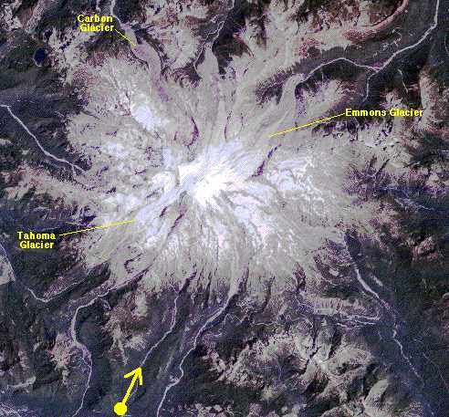
Enlargement of Mount Rainier seen in aerial photograph. Colors in this image have been stretched to show the glaciers, which would otherwise appear a featureless white. Yellow spot with arrow shows approximate location of airplane and viewing direction of the camera when the photograph was taken.

Image: S. K. Croft. Raw TM scene #Y5308418181X0. These data are distributed by the EROS Data Center Distributed Active Archive Center (EDC DAAC), located at the U.S. Geological Survey's EROS Data Center in Sioux Falls, SD.

Button that takes you back to the Temperate Rainforest main page.


HTML code by Chris Kreger
Maintained by ETE Team
Last updated November 10, 2004

Some images © 2004 www.clipart.com

Privacy Statement and Copyright © 1997-2004 by Wheeling Jesuit University/NASA-supported Classroom of the Future. All rights reserved.

Center for Educational Technologies, Circuit Board/Apple graphic logo, and COTF Classroom of the Future logo are registered trademarks of Wheeling Jesuit University.