 |
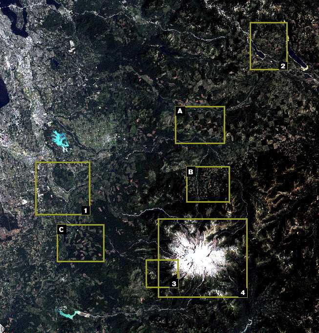
| Part of a Landsat Thematic
Mapper (TM) image of area around Mount Rainier. Width of the image is about 93 kilometers.
Click within any yellow box to see aerial photograph and/or enlargements of outlined area. Image: S. K. Croft. Raw TM scene
#Y5308418181X0. These data are distributed by the EROS Data Center Distributed Active
Archive Center (EDC DAAC), located at the U.S. Geological Survey's EROS Data Center in
Sioux Falls, SD. [ A
] [ B
] [ C
] [ 1
] [ 2
] [ 3
] [ 4
] |

HTML code by Chris Kreger
Maintained by ETE Team
Last updated November 10, 2004
Some images © 2004
www.clipart.com
Privacy
Statement and Copyright ©
1997-2004 by Wheeling Jesuit University/NASA-supported Classroom of the Future. All
rights reserved.
Center for Educational Technologies, Circuit
Board/Apple graphic logo, and COTF Classroom of the Future logo are registered
trademarks of Wheeling Jesuit University.