 |
|
GOES weather satellite image |
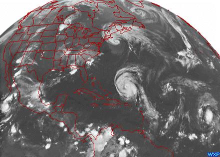 This Geostationary Operational Environmental Satellites (GOES) infrared image was taken on September 2, 1996. It shows Hurricane Edouard just leaving the New York area and Hurricane Fran north of Puerto Rico bearing down on the American East Coast. Photo courtesy of NGDC/NOAA. [ next ] |