 |
|
SIR-C radar image |
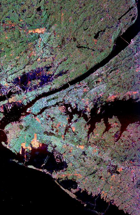 This radar image of New York City was made by the Spaceborne Imaging Radar-C/X-band Synthetic Aperture Radar (SIR-C/X-SAR) instrument aboard the space shuttle Endeavour in October of 1994. Radar images essentially show the texture of the surface being imaged. The colors in this image are artificial and indicate differences in how trees, buildings, roads, and natural ground surfaces scatter and reflect the beam sent out by the radar on the shuttle. The resolution is high enough (about 25 meters) in this image that most major streets, large buildings, and even ships in the harbors are visible. Image courtesy of JPL Imaging Radar site. ... |