 |
|
Landsat mosaic |
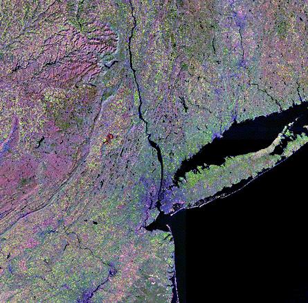 This mosaic of New York City and its surroundings was created from four Landsat Thematic Mapper (TM) scenes. TM bands 5, 4, and 3 are presented in red, green, and blue, respectively. In this combination of bands, clear water appears black, urban areas show in shades of purple, green vegetation is shades of green, and bare rock or soil and dried vegetation are in shades of magenta and brown. The location of urban areas, forested areas, and the underlying geologic structure of the region are clearly seen. The data were taken in the late fall of 1986. The mosaic shows an area about 360 km wide. Mosaic by S. K. Croft. These data are distributed by the EROS Data Center Distributed Active Archive Center (EDC DAAC), located at the U.S. Geological Survey's EROS Data Center in Sioux Falls, SD. [ next ] ... |